The city that begins with a single idea
A person opens a digital map and finds a city that means something to them. Perhaps it is where they grew up. Perhaps it is the place their grandparents once called home, or the city they have visited so often that its streets feel familiar. The name is already known. The geography tells a story before anyone has created a single new building.
Now picture a second scene. A designer creates a remarkable 3D pavilion inspired by that city's architecture. A local history enthusiast prepares photographs and stories that could explain why a particular square matters. A landowner offers a suitable location for the installation. A Governor notices that the separate ideas could work better together than alone.
They start small. One landmark. One recognizable theme. One reason for somebody else to look more closely.
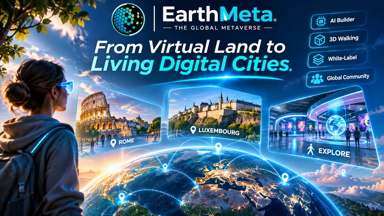
Eventually, in a more interactive version of the experience, a newcomer might discover the pavilion, follow a route past several installations, learn something about the city and decide to return to see what has changed. The illustrations in this article show that possible direction; they are not demonstrations of features that are already available.
The interesting part is not the size of the virtual building. It is the relationship between a real place, a digital asset, a creator's effort and another person's curiosity.
That leads to the question at the heart of this article: what makes a virtual city truly valuable?
There is an obvious financial answer: what somebody will pay for a city or its land. That matters in a marketplace. But there are other kinds of value that deserve just as much attention: recognition, creative identity, useful content, cultural relevance, relationships between owners and creators, and the ability to turn a digital location into an experience people actually want to discover.
For EarthMeta, these ideas are particularly interesting because the project does not begin with an entirely fictional world. Its starting point is the geography of the planet we already know. That gives its users a foundation many virtual worlds must create from scratch: places that already carry names, memories and meaning.
And that is where the opportunity begins.
A map gives a city its location. People give it a reason to matter.
1. EarthMeta explained for someone who has never used it
EarthMeta is a blockchain-based digital-world project organized around real-world geography. Countries and cities form the framework of its map. Digital city, land and building assets exist within its ecosystem, while creation tools allow users to develop visual content connected to those locations. The platform currently describes its NFT and EMT ecosystem as operating on Ethereum following its 2026 migration. 12
If that sounds complicated, it helps to separate four simple ideas.
First, there is the map. A place on EarthMeta corresponds to a real-world geographic location. A city such as Lisbon, Bratislava or Tokyo carries a recognizable identity even before a user adds a digital creation. A recognizable name is a starting advantage, not a promise that the virtual environment already reproduces every street or building in full detail.
Second, there is digital ownership. A city NFT represents a unique city asset in EarthMeta. Its holder becomes the city's Governor. Individual land assets have their own holders, and 3D creations are another type of digital asset within the platform's ecosystem. These are rights associated with digital assets and EarthMeta's rules, not ownership of buildings or land in the physical city. 13
Third, there is a marketplace. EarthMeta provides ways to discover and trade supported city, land and building NFTs. Under the platform's published model, the holder of a city NFT is eligible for a 1% Governor fee on applicable marketplace transactions within that city. A President role exists at country level with a published 0.5% mechanism. Those amounts are linked to actual qualifying trading, not to visitor numbers, physical property transactions or a fixed payout. 34
Fourth, there is creation. EarthMeta describes its AI-assisted 3D Builder, construction tools and external model imports among its delivered capabilities. A person does not have to start by making a professional game in order to begin exploring the creative side of a digital location. However, creating a model, placing it on authorized land and making it part of a fully interactive experience are not identical technical steps. 25
That is the essential picture: a world map with a digital asset layer, tools to develop what appears in its locations, and a community of people who may own, make, trade or explore different parts of it.
It is also important to understand what EarthMeta is not. A Governor is not a municipal government official. A virtual parcel does not grant rights over a real house. A 3D pavilion is not automatically a working business. And an impressive concept illustration is not proof that every envisioned interaction is available today.
Those distinctions do not weaken the idea. They make it easier to see where meaningful development can actually begin.
Quick check: did it click?
Five small questions on what you just read. Get one wrong and you will see why, plus the right answer. Your grade comes at the end.
2. The moment ownership becomes an opportunity
The act of acquiring a digital location can be exciting. You choose a city or parcel, understand the asset, complete the relevant transaction and gain the platform rights attached to it. For a Governor, there is a city to oversee and a defined economic role within EarthMeta's marketplace. For a landowner, there is a particular location that can become the setting for a project.
But the purchase is a beginning, not a finished experience.
Consider two hypothetical parcels. One holds a striking 3D object with no explanation, no theme and no connection to anything around it. The other holds a smaller, carefully designed structure with a clear name, a compelling description and a recognizable relationship to its city. The first might be visually impressive. The second may give a visitor something more memorable: a story worth following.
Neither parcel is guaranteed to sell for more. Neither is guaranteed an audience. Yet the contrast illustrates something important: there is a difference between the market price of an asset and the experience that asset makes possible.
A Governor who understands this difference can think more like a curator than simply a seller. What is the city's identity? Which part of its history deserves attention? What kind of architecture belongs here? Are there local creators whose work would add something distinctive? Should several parcels share a common theme rather than compete for attention with unrelated structures?
Landowners can bring an equally valuable perspective. They are closer to the individual site: its placement, its specific concept and the details that make a building or installation worth investigating. One may want a cultural exhibition. Another may prefer a modern design showcase. Someone else may be interested in a sports-themed landmark.
The objective is not to force every owner into the same plan. It is to recognize that a city can become more interesting when individual projects fit into a larger story.
A good digital city does not need to look exactly like its physical counterpart. It can celebrate the original, reinterpret it artistically or propose something entirely new, as long as viewers understand what they are seeing. A futuristic exhibition inspired by an old harbor is different from claiming that such a building already exists in that harbor. The first is creativity; the second would be misinformation.
Digital ownership gives creators a defined place to begin. A thoughtful concept gives that place a reason to matter.
3. Six different meanings of value, and why they should not be confused
When people discuss the value of virtual property, six ideas often get mixed together. Separating them is useful for newcomers, Governors and anyone planning a serious project.
1. Ownership value: a defined place within the ecosystem
A city or parcel NFT can establish a specific digital holding under EarthMeta's platform rules. For people who want a long-term presence in a recognizable location, that distinction matters. It gives the project an identifiable home and a record of its asset ownership.
2. Location value: a name with a story attached
Real cities already have associations. Some are known for historic centers, others for design, education, technology, music, food or dramatic landscapes. Connecting a digital project to such an identity can make the initial explanation easier. You can tell somebody why you chose a particular location without first inventing a new fictional geography.
3. Creative value: something original to discover
An unusual building, sculpture, pavilion or collection of designs can give a parcel character. Creative value depends less on how many objects exist and more on whether the work has quality, coherence and an identifiable idea. Ten carefully designed pieces may tell a stronger story than one hundred randomly placed ones.
4. Use value: a reason for somebody to spend attention
A visitor may want to learn about architecture, examine a creation, discover a local story or see what a community has assembled. Such purposes can be modest and still meaningful. Not every useful experience must begin with a complicated AI character or payment integration.
5. Community value: people who contribute, not just own
A digital location becomes more interesting when people care enough to improve it. The Governor, a parcel owner, a 3D artist, a photographer and a curious visitor do not have identical roles, but their contributions can reinforce one another. More creators may produce richer content; richer content may give visitors more reasons to explore; feedback may help creators make better decisions.
6. Market value: the price another person will actually pay
This is the financial dimension, and it cannot be inferred from the other five. A beautiful building does not establish the resale price of its parcel. A famous physical city does not guarantee liquidity for its digital counterpart. Prices depend on what actual buyers are willing and able to pay, among many other factors. EarthMeta's own risk disclosure explicitly warns that assets can lose value and may not find a buyer. 4
The distinction is crucial. Creative, cultural and social value can be pursued through actions. Financial results cannot be promised by an article, a rendering or a project roadmap.
4. A city you recognize is a story you can start telling
What does geography contribute that a blank virtual landscape does not?
Consider a creator who wants to build a cultural project around Sarajevo. Their starting material could be the recognizable old town, its architectural contrasts, stories of trade and crafts, or the river running through the city. An entirely imaginary world could also host a wonderful gallery, but it would not begin with the same shared cultural references.
Or consider a Governor developing a theme for Bratislava. A visual concept could draw on its riverfront setting, historic core and contemporary architecture. A designer could make one object inspired by the city, then another, then a small related collection. The work would not need to pretend to be a perfect digital reproduction of the physical city. It could announce itself as an imaginative interpretation of that place.
That is the distinctive advantage of recognizable geography: it supplies context, not finished content.
The context can help a city owner answer practical questions. Where does the theme belong? What should a visitor understand first? Which objects would feel connected? Which local stories are reliable and worth checking? What photographs, maps or historical materials could support a description? Who might care about seeing this project?
It also creates responsibilities. Real places have histories and communities. A design inspired by a monument should not misrepresent its origins. A brand logo should not be used as if a company officially partnered with a city owner. A virtual museum should distinguish sourced historical information from artistic reconstruction. Clear attribution and respectful descriptions are not obstacles to creativity; they make a project easier to trust.
The most compelling use of a real-world map is not necessarily copying everything exactly. It may be combining recognition with originality: a place that feels familiar enough to enter, but imaginative enough to explore.
5. Four people can shape a city in four different ways
Imagine a small project team trying to create a beautiful digital waterfront district. No one person needs every skill. The roles can be complementary.
Who shapes a city, and how
The Governor is the holder of the city NFT and a key participant in the city's overall direction. A Governor might help establish a theme, identify available opportunities, connect people interested in similar projects, and explain how city assets relate to the platform's marketplace. The exact permissions for any particular action depend on current EarthMeta rules and who owns the relevant land.
The landowner works at the level of an individual parcel. Their contribution could be a location for a specific display, a coherent description, a distinctive building or an arrangement with a creator who has something to show. Being located inside somebody's Governor city does not erase the landowner's separate digital rights.
The creator provides the ideas and the objects: a building generated with available AI tools, an externally produced 3D model imported through a supported workflow, a thematic visual collection or a carefully researched concept. Creativity may be the most visible contribution, but it is not always tied to ownership of an entire city.
The visitor contributes attention, feedback, discovery and, where supported, participation. Visitors are not less important because they may not hold a city NFT. On the contrary, they are a potential audience for the work owners and creators make. Their interest does not automatically translate into marketplace transactions, but without an audience it is difficult to know whether a project resonates beyond its makers.
These are different roles, and a single person may play more than one. The critical lesson is that ownership and participation are not opposing ideas. They are complementary parts of a digital ecosystem. Imagine a Governor inviting three owners to develop one theme along a virtual street. An architectural creator supplies a shared visual style. Another contributor writes short descriptions based on properly sourced local history. Each owner retains the appropriate rights to their assets. Instead of a disconnected set of objects, the city begins to show a coordinated identity.
That is not a new product feature being announced here. It is a way people could organize themselves around the capabilities and permissions that actually exist.
6. The first great city project might fit on a single parcel
Big virtual worlds tempt people to think in enormous scales. Entire skylines. Hundreds of buildings. Stadium districts. A city filled with characters, businesses and interactive experiences.
Those ideas can be exciting, but starting with the whole city often makes it harder to finish anything.
A better approach is to treat the first project like a carefully designed exhibition. Choose a subject, make one strong object and show why it belongs in its location. Then improve it. Only after the first version is convincing should you decide what comes next.
A creator might begin with a modern pavilion. Instead of typing a vague prompt such as make a cool futuristic building, they can define its purpose, silhouette, materials, proportions and surroundings. For example: a small riverside cultural pavilion; warm stone at ground level; glass along the water-facing side; a sheltered entrance; a restrained contemporary roof that echoes the lines of nearby historic buildings.
The creator can experiment with the tools EarthMeta currently provides or use a compatible external modeling workflow. The next step is not automatically to sell, host an event or promise an interactive interior. It is to inspect the result: Does the model look right? Is it technically compatible? Can it be placed at the intended location under the owner's permissions? Does its scale make sense? Does it communicate the idea clearly?
Then comes something many digital projects neglect: an explanation. What is this object? Who made it? Why is it here? Is it based on historical research or an original artistic concept? If you show it to a stranger, can they understand the purpose without a ten-minute conversation?
A name and a short, well-written description can change the experience of discovering an object. The visual attracts attention; the explanation gives the attention somewhere to go.
One good pavilion does not create a thriving metropolis. It does, however, establish a visual and editorial standard that other pieces can follow. A second related structure makes a collection. A third can begin to suggest a route or district. A design language emerges. New contributors have something concrete to respond to.
This progression matters because EarthMeta's roadmap refers to more powerful construction and district tools, but creators do not need to pretend those future systems are already available in order to start building coherent collections today. 25
7. Three projects that could give a city a recognizable identity
The following examples are fictional proposals, not finished EarthMeta attractions, partner announcements or demonstrations of services currently available. They are deliberately designed to begin with relatively understandable visual work. Each also shows where more advanced interactive features would be required.
Project A: The Memory Walk, a city that tells its own story
Imagine someone who grew up in a city but now lives thousands of kilometers away. They still remember a particular square, a riverbank, a market or the view of familiar rooftops at sunset.
They know the city has stories that tourists often miss and that younger generations may never hear firsthand.
Instead of trying to rebuild every street, they choose five moments worth remembering: a historic place, a traditional craft, a celebrated architectural feature, a local cultural story and a modern reinterpretation created by a digital artist.
The first EarthMeta edition could be a collection of five visual installations or landmarks, each designed for an appropriate parcel with the relevant owner's cooperation. One could be a stylized sculpture inspired by a traditional craft. Another could be a pavilion devoted to a historic building. A third could be a contemporary structure showing how the city might be interpreted by a new generation of designers.
The crucial work is not only creating models. It is researching accurate material, obtaining permissions for photographs or artwork where needed, writing understandable descriptions and presenting the collection as a coherent series. An optional external webpage could host longer stories or sources if the available EarthMeta experience cannot display them in the intended way.
The audience is easy to understand. It could interest people from that city, members of its diaspora, architecture enthusiasts, curious visitors and creators looking for cultural references. That is a plausible audience hypothesis, not evidence that such visitors already exist on EarthMeta in large numbers.
How would the project develop? The first milestone is a single attractive, properly described landmark. The second is a small themed collection. The third is a clearly presented overview explaining how the pieces relate. A future edition might use interactive exploration or intelligent guides if the necessary EarthMeta features become available and reliable.
The project would succeed first if it communicated something real and distinctive about the city. It would not need a ticketing system, virtual hotel or speculative NFT price forecast to justify existing as a cultural experiment.
A real place provides the memories; digital creation gives them a new form.
Project B: Tomorrow's Square, the architectural district that starts a conversation
Some places are fascinating because of their history. Others invite us to think about the future. A digital city can accommodate both.
Suppose several creators agree to develop a small futuristic architectural district. One imagines a library made from layered timber and glass. Another proposes a public garden under a lightweight canopy. A third designs a sculptural tower with a distinctive silhouette. None is presented as approved construction in the physical city. They are original 3D design proposals connected by a shared theme.
The Governor's contribution could be helping establish the district idea and inviting interested parcel owners to collaborate. The creators agree on a few basic standards: approximate scale, color palette, naming conventions and the information every design should include. The landowners decide which projects suit their parcels and which placements or uses are allowed.
The project could begin with only three buildings. Yet three carefully coordinated structures may already feel like a recognizable place. Add a design statement, author credits and a description of the inspiration behind each one, and it becomes more than a random row of futuristic objects.
There is a useful educational angle here. A design student might see how different creators interpret the same problem. An architecture enthusiast might compare shapes and materials. A visitor might simply enjoy discovering unusual structures placed within recognizable geography.
A later stage could involve a creator competition or a public showcase organized through the project's actual available community channels. More elaborate events, walkable interiors or real- time collaborative tools would have to be checked against the platform's current capabilities rather than assumed to exist.
The important distinction is between building a convincing visual district and running a fully interactive digital city simulation. The first is a focused creative challenge. The second involves additional engineering, moderation, performance and platform features.
One person can create a striking building; several people working to a shared brief can create a place with character.
Project C: The Stadium Beyond Match Day, an attraction with more than one audience
A spectacular digital stadium is an obvious visual challenge. Its shape can be recognizable from a distance; its scale makes it exciting; and sports connect people across languages and countries.
But what would make a stadium concept more than an impressive shell?
The first version could focus on original architecture: a distinctive roof, a welcoming entrance, landscaping and design details. A creator could prepare images showing the stadium from different angles and publish a short explanation of the design. The goal at this stage is an architectural landmark, not a claim that competitive games or live concerts already run inside it.
A second stage could add complementary visual elements around the stadium: a sculpture garden, a plaza celebrating different sports, or a small design exhibition about the evolution of stadium architecture. The venue starts to tell a broader story about sport, engineering and gathering places.
A third stage could explore more ambitious experiences (fan exhibitions, digital events, social interaction or entering the venue itself), but only when the platform supports those functions in a way that can be tested. A stadium model does not become a functioning multiplayer sports game merely because it has seats and a pitch.
This example also raises a practical issue: branding. A creator should not use a professional club's badge, claim official sponsorship or reproduce protected designs without checking the necessary rights. An original fictional arena can be exciting on its own.
What makes this concept interesting is not a promise of instant commercial demand. It is the ability to begin with a visible landmark that people can recognize, discuss and improve, while leaving more advanced experiences as clearly defined future possibilities.
Start with a place worth looking at; build toward a place worth participating in.
Have a city story to build?
Find the place that means something to you on EarthMeta and start with one landmark.
8. How a small project can grow without losing its identity
Think about the common problem of a growing city: every person wants to build something impressive, but the result can become visually chaotic. Five extraordinary objects do not necessarily create one extraordinary neighborhood.
A simple framework can help, even before any automatic district generator exists. Give each project five pieces of information: its name; its location; its purpose; its creator or owner; and the relationship it has to other projects nearby. Then decide whether it belongs to a broader visual theme.
A creative street might have a common material palette and a collection of contrasting architectural styles. A cultural route might connect installations that each explain a different part of the city's heritage. A sports district might center on a recognizable arena and use smaller supporting structures rather than filling every parcel with a second competing stadium.
The result is not uniformity. It is coherence. Visitors should be able to understand why different things appear in the same place.
The goal is not to fill every square meter. It is to make the places that exist worth discovering.
This is where the Governor role may become interesting beyond its economic mechanism. A Governor who encourages collaboration, curates themes and helps make projects discoverable can contribute to a city-wide sense of direction. But the Governor's city NFT does not automatically override individual parcel ownership or grant unrestricted authority over every user's creation. Collaboration requires consent and clear understanding of each participant's rights.
It also calls for realistic planning. A good creator brief might specify compatible asset formats, maximum model complexity where relevant, a shared visual concept, what artwork may be used, who is responsible for maintenance and whether participants are offering a model for display or transferring an NFT asset. These details sound less glamorous than futuristic skylines, but they help prevent misunderstandings later.
There is a creative reward for doing this groundwork. Once a small collection becomes coherent, new contributors can see where they fit. The city stops being a blank instruction to "build anything" and becomes an invitation to help develop something recognizable.
9. What EarthMeta offers today, and what still belongs to the future
A serious article about an emerging platform should be enthusiastic without confusing its roadmap with the current product.
The present foundation, according to EarthMeta's published site and roadmap, includes the mapped digital city and land ecosystem, the NFT marketplace, Governor and President mechanisms, AI-assisted 3D creation, construction tools and support for importing external 3D models. Its official materials also refer to avatars and developer/API work among completed milestones. Specific formats, user permissions, access conditions and availability should always be checked in the live application. 125
The next layers are more ambitious. EarthMeta's AI page labels NPC populations as coming soon and full-district generation as a future direction. Its roadmap lists the AR application and mobile wallet as launching soon rather than as completed items as of the publication date of this article. The long-term possibilities include richer social interaction, more responsive environments and broader integrations, but a roadmap is not a release confirmation. 25
These distinctions matter in the examples above. A visual gallery assembled from supported 3D objects is not the same as an autonomous museum guide. A digital shopfront is not an integrated point-of-sale system. A stadium exterior is not a playable sporting event. A 3D model that looks like a restaurant does not automatically have a functioning kitchen, reservations or staff.
The good news is that worthwhile creative work does not depend on all those later features arriving at once. People can develop identities, visual concepts, project descriptions and collections in stages. When additional capabilities become available, those projects may have a clearer purpose for using them.
Why the proposed AI tourist guide is interesting
One upcoming idea is especially relevant to EarthMeta's geography-based approach: AI characters that know something about the cities they inhabit. The project describes future NPCs that may be able to answer questions about cities, streets and owners. 5
A generic chatbot can discuss the history of a real-world city. A genuinely useful EarthMeta guide would need something more specific: reliable information about what creators have actually placed in the virtual city, what those objects represent and what a visitor can access there. That requires structured information, permissions, updates and methods for preventing the agent from making things up.
A useful guide might one day say, "There is a creator-designed pavilion nearby; would you like to learn about it?" That would be an excellent bridge between the geography of the city and the work of its digital community. But until such an agent is deployed and tested, that sentence remains a scenario, not an existing service to advertise.
The same principle applies to future external integrations. APIs can support applications, but published API documentation does not automatically mean that every third-party AI NPC, booking platform or commerce service can be connected today. Those integrations require explicit support and security decisions.
The best long-term strategy may be to build meaningful things with today's tools and give tomorrow's tools a useful purpose when they arrive.
10. Can these ideas create a real economy?
This is where enthusiasm needs precision. EarthMeta has a genuine economic design in the sense that its digital assets can be traded through a marketplace and certain on-chain roles receive published portions of qualifying transaction activity. The EMT token functions within the platform's ecosystem. That is different from showing that a particular virtual building already earns commercial revenue from visitors. 134
For a simple illustration, if a qualifying marketplace sale within a city were 1,000 EMT, a 1% Governor allocation would equal 10 EMT under the stated mechanism. That is a calculation, not a forecast: if no qualifying transaction happens, that example produces no fee. The value of any EMT received can also fluctuate.
Take the Memory Walk from our first example. Suppose a Governor helps coordinate five heritage- inspired installations. The creators might produce valuable content and generate community interest. That could be worthwhile in its own right. But it would not automatically produce ticket sales, NFT purchases or recurring fees. To earn a Governor fee, qualifying marketplace activity actually has to occur within the applicable territory. 4
A business pavilion has a similar distinction. It can be a visual presentation of a business idea. For it to become a functioning commercial service, it needs an actual customer journey, an authorized way to display products or services, appropriate payments where supported, customer service, relevant consumer protections and whatever platform integrations are necessary. A 3D storefront alone is a design, not a completed commercial operation.
There are also costs: creating and revising 3D assets, obtaining creative rights, acquiring or using land, maintaining project materials, and possibly transaction or network fees. The official EarthMeta website contains different published marketplace-fee figures in different places; the correct rate must be resolved from the current transaction route and terms rather than assumed from a promotional headline. 36
None of that makes the creative opportunity less interesting. It changes the order of operations. First, define something useful or memorable. Second, make a credible version. Third, find out whether people want to engage with it. Only then develop a realistic commercial model around a demonstrated need.
That approach also protects the core attraction of digital ownership. Buying a city or parcel can be an exciting choice within EarthMeta. But describing the asset accurately and understanding its risks is better for long-term credibility than promising it will become more expensive simply because more buildings are added to the map.
11. What would I do with one city and a modest creative budget?
If I had to advise a Governor who wants to do more than wait for future releases, I would not begin by commissioning a massive skyline. I would start with one question: what should somebody remember about this city after seeing its first three creations?
That question forces useful choices. A historic city might lean into cultural identity. A technology- oriented city might become a showcase for experimental architecture. A smaller hometown could be an especially personal project, built around stories larger platforms tend to overlook.
I would write a one-page creative brief. It would describe the proposed theme, intended audience, the small number of assets required and the rights or permissions needed to place them. I would select one flagship object and one supporting visual element. I would define a simple standard for names and descriptions so the work could be understood by somebody outside the immediate project team.
Then I would make the first version as well as possible. This could involve EarthMeta's current AI Builder or a compatible imported model, depending on the creator's capabilities and the intended asset. I would verify placement and presentation in the live product rather than relying entirely on a polished rendering made elsewhere.
Next, I would invite specific feedback. Not "Is the metaverse the future?" but "Does this look like a cultural exhibition? Can you tell what the building represents? Is the description clear? Would you want to see a second piece in the collection?"
Those questions produce more usable answers. They tell a creator whether the project is communicating its idea rather than merely collecting compliments.
If the response is promising, I would invite one or two collaborators with complementary skills. Perhaps a local researcher who can verify the history, a 3D designer who specializes in materials, or another parcel owner who shares the theme. I would keep agreements straightforward about ownership, credits, permissions and responsibility for updates.
The aim in the first months would be a small, recognizable collection, not a pretend bustling metropolis. A project with three excellent objects and clear documentation is easier to develop than a grand plan that depends on ten unreleased features.
12. A realistic 90-day project: build, invite, improve
A useful creative plan should end in something visible. Here is a proposed 90-day sequence, not an EarthMeta-sponsored program or promised platform milestone.
Tick each phase as your project moves forward
0 of 6 phases done
Choose the city or parcel, confirm the relevant ownership and placement rights, settle on one theme, gather trustworthy source material and define the first visitor-facing idea. Write a short description in ordinary language. If somebody cannot understand the concept in three sentences, refine it before generating assets.
Build or import one strong 3D model using available tools. Inspect it at the intended scale. Adjust geometry, textures and visual emphasis as needed. Prepare a properly attributed concept description. Test the model in the actual supported workflow, not only in an external preview.
Create clear imagery and text showing what the object is, why it belongs here and what it could become. If the platform has limits on information display, use supported links or community channels without representing them as features inside the 3D world. Show the first version to people who are not already emotionally invested in it.
Invite another creator or parcel owner if the legal and platform permissions make sense. Produce a second object that strengthens the original theme. Agree on naming, credits and maintenance. A second carefully chosen piece is often more useful than ten unrelated additions.
Publish a concise story through appropriate EarthMeta community channels, showcase the concept in a short video or visual sequence, and make it obvious where to find the relevant assets. Avoid claiming visitor numbers, partnerships or technical capabilities you have not verified.
Review what was built, what worked and what caused trouble. Collect feedback. If actual platform analytics are available to the relevant owner, use them carefully; otherwise record straightforward measures such as creator participation, completed assets, questions received and updates made. Choose one improvement for the next phase.
Your ticks are saved in this browser only.
At the end of ninety days, the project should have a recognizable identity, a documented set of creations and a clearer sense of what people find interesting. That is a much more useful result than an enormous roadmap built entirely out of future-tense promises.
13. How do you know when a virtual city is becoming better?
The obvious temptation is to open the marketplace and check prices. Those numbers may matter to owners, but they are not a complete measure of creative progress.
A small city project can ask more revealing questions. Did we finish the landmark we promised ourselves? Is its description accurate and understandable? Did a second creator find it interesting enough to contribute? Can someone outside our group explain what makes the installation special? Do the objects belong together visually? Have we improved anything based on actual feedback?
Over time, a Governor may also care about discoverability, repeat interest, the number of completed collaborative projects and the quality of asset information. Those measures require appropriate data. They should not be invented because they look good in a chart.
A large city NFT portfolio and an excellent creative project are two different achievements. One does not establish the other. A healthy conversation about EarthMeta can make space for both: people who value digital ownership and people who enjoy turning digital locations into distinctive experiences.
If the ecosystem develops more interactive features, new ways to evaluate projects may become possible. But the basic principle remains: measure the thing you actually set out to create. A cultural exhibition should be judged first on the quality of its presentation. An architectural showcase should be judged on design and clarity. A collaboration project should be judged on whether people can reliably work together.
Then market activity can be considered on its own terms, using real transactions instead of assumptions.
14. Questions worth answering before anyone gets lost in the terminology
Do I have to buy an entire city to be involved?
No. EarthMeta describes different digital assets and participation roles. A city NFT creates the Governor role; individual parcels and supported 3D creations are separate opportunities. Access and permissions depend on the platform's rules and current product. 13
Is an EarthMeta city a perfect playable copy of the physical city?
EarthMeta uses real-world geography as its organizing principle and describes a digital twin of Earth. That should not be confused with a verified claim that every physical building, street interior or real-time city activity has already been reproduced as a navigable experience.
Does owning a city make me its real mayor?
No. Governor is a digital role attached to the EarthMeta city NFT. It does not grant authority over the physical municipality or its property.
What is the difference between a land NFT and a 3D model?
The land NFT concerns an identified digital location and its platform rights. A 3D model is a visual creation. Depending on the current system, a model can be a separate asset or be placed in a supported location. Their technical and ownership rules should not be treated as interchangeable. 3
Can I create a building without professional 3D skills?
EarthMeta publishes AI-assisted creation tools and a builder designed to lower the entry barrier. The quality of the result still depends on good instructions, refinement, and compatibility with the platform. 5
Can a virtual shop automatically sell real products?
A digital storefront is not automatically connected to a real inventory, checkout, consumer-support system or payment provider. Those require explicit integrations and operational arrangements; do not infer that they are available because a 3D shop exists.
Are NPC tourist guides and full-district AI generation live?
EarthMeta's AI page describes NPC populations as coming soon and full-district generation as a future direction. These should not be presented as released features until EarthMeta confirms deployment. 5
Does the Governor receive money when visitors simply walk around?
The published Governor mechanism concerns qualifying marketplace transactions inside the city. An ordinary visit is not the same as an NFT trade. 4
Does building something impressive guarantee a higher NFT price?
No. Creative quality and asset market price are different things. Buyers, liquidity, broader market conditions and platform adoption all influence what an asset may sell for. 4
Where should a newcomer begin?
Begin by exploring the official site, understanding the difference between city, land and building assets, reading the current platform rules and trying a small creative idea. If considering a purchase, review the particular asset, total costs and risk disclosures rather than relying on a promotional projection. 146
15. The bigger opportunity is not to make every city the same
One of the most appealing features of EarthMeta's real-geography idea is the possibility that different places might develop different creative identities. A city known for art might attract people interested in galleries. A coastal city could inspire environmental design or imaginative waterfront architecture. A smaller hometown might become a remarkably personal collection of local stories.
There is no reason every city needs its own copy of the same glass skyscraper, the same giant stadium and the same neon shopping mall. Nor should every Governor feel pressure to transform an entire map into a finished entertainment district overnight.
The goal can be more interesting than that: let cities become recognizable for something.
Some locations might remain primarily collectible digital assets. Some could become showcases for design. Others might develop cultural collections, creator collaborations or projects that later benefit from additional interactive tools. Different owners will choose different paths, and the available platform features will shape what can be achieved in practice.
If EarthMeta continues to improve the bridge between geography, ownership, creative tools and accessible experiences, there is room for a powerful network effect. A good creation gives people a reason to look. Discovering it can lead them to another creator. A shared theme can connect several parcels. A city with a memorable identity can inspire related projects in other places.
That is an opportunity, not an inevitable outcome. It requires dependable tools, compelling work, clear ownership rights, real participants and time. But none of those ingredients is imaginary. People already make digital art, build 3D models, research local history, form communities and care deeply about places.
EarthMeta's distinctive proposition is to give some of those activities a common geographic and digital-ownership context.
The real question is what we choose to build
A map can show where a city is. A blockchain can record a digital asset. A 3D tool can help create a building. A marketplace can enable a trade.
But none of these, by itself, can tell a visitor why a place deserves their attention.
That part belongs to people: the Governor who cares about the city, the landowner with an idea for one special location, the creator who turns the idea into a visible form, the researcher who adds context, and the visitor who discovers something worth sharing.
A virtual city becomes more meaningful when those contributions begin to connect. Not because its future has been guaranteed, but because something new has actually been made.
EarthMeta's geography gives us places with names we recognize. Its digital assets offer a framework for ownership. Its creation tools provide a way to start making things. Its future roadmap points toward richer interaction, but the most important creative decision does not have to wait for every future milestone.
Choose a place. Give it a story. Create something worth seeing. Invite others to make it better.
Because the next memorable destination in a digital world may not begin with an enormous technical breakthrough. It may begin with one owner, one creator, one idea, and a very good reason for someone else to visit.
Sources and editorial transparency
This is an independent community perspective, not an official product announcement or financial advice. All example cities, project concepts, visitor journeys and illustrations in this article are educational or imaginative proposals unless explicitly identified as existing EarthMeta capabilities. Official site information reviewed on 6 November 2026; functionality and policies may change.
- [1] EarthMeta: official website and Cities: real-world mapped cities, NFT roles, AI creation overview, Ethereum network.
- [2] EarthMeta: roadmap: phases marked completed, external 3D model import, APIs, and later mobile/AR status.
- [3] EarthMeta: marketplace and How it works: city, land and building assets; the Governor/President marketplace structure.
- [4] EarthMeta: risk disclosure, updated 20 October 2026: in-platform rights, transaction-dependent fees, liquidity, market and delivery risks.
- [5] EarthMeta: AI page and Staking status: AI creation versus coming NPCs and later districts; staking-window status.
- [6] EarthMeta: Terms of Use and Marketplace overview: verify current fees and applicable transaction route; published figures are not consistent across all site pages.
- [7] EarthMeta Whitepaper V2, supplied by the article author for this research: original description of the digital Earth, Governor model, land delimitation and APIs. Its older network references and earlier release forecasts must be read alongside the current site and roadmap.
Official pages: earthmeta.ai · Cities · AI · Roadmap